Research
Current Projects
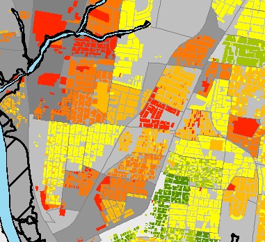
Agricultural Diversity and Productivity A study of the relationship between the composition of agricultural landscapes and agricultural production for the conterminous United States. This project is conducted in collaboration with Emily Burchfield, Assistant Professor in the Department of Environmental Sciences at Emory University. Scales of Social Vulnerability A study investigating the impact of scale of social vulnerability maps on hazard planning. Funded by a KSU University Small Research Grant. Wildcat Creek Watershed Project building a university-community partnership for sustainable development of the Wildcat Creek Watershed. Funded by a KSU Center for Engagement and Community Development Engagement Incentive Grant. Urban Flood Adaptation A project evaluating the costs and benefits of a home buyout program as an urban flood adaptation strategy using alternative history scenario analysis. Includes assessment of direct flood damages avoided, the flood mitigating secondary effects of conversion of developed land to open greenspace, and the impact of the program on trajectories of community sustainable resilience to flooding. FEMA Buyouts Examination of FEMA buyout program describing the socio-demographic landscape of buyout neighborhoods and communities. Measuring Rurality A systematic review of rurality measures and indices and development of a new extended rurality measure.
Recent Projects

Sustainable Resilience A study examining dependencies between the concepts of Resilience, Vulnerability, and Sustainability. Includes development of a dynamic assessment framework for social-environmental systems that includes elements of all three concepts, and identification of standard indicators for community sustainable resilience assessments. Water Rights A study examining the relationship between the hierarchical structure of water rights, drought conditions, and vegetation health in California's Central Valley. Inland Waterway Operational Procedures A project examining the influence of Waterway Action Plan operational procedure guidance on shipping activities on inland waterways. Developed an agent-based model of tow traffic on the waterways that responds to changing tow operation procedures that may result from severe river and weather conditions. Dasymetric Social Vulnerability Mapping A project extending dasymetric mapping techniques for high resolution social vulnerability mapping. Transportation Vulnerability A project that developed a screening tool for regional transportation vulnerability assessments.
Recent Publications
- Burchfield, E.K., Nelson, K.S., & Spangler, K. (2019). The impact of agricultural landscape diversification on U.S. crop production. Agriculture, Ecosystems & Environment. doi:10.1016/j.agee.2019.106615
- Gillespie-Marthaler, L., Nelson, K., Baroud, H., & Abkowitz, M. D. (2019). Selecting Indicators for Assessing Community Sustainable Resilience. Risk Analysis. doi:10.1111/risa.13344
- Nelson, Katherine, S., Leslie Gillespie-Marthaler, Hiba Baroud, Mark Abkowitz, and David S. Kosson. (2019). An Integrated and Dynamic Resilience Assessment Framework for Complex Adaptive Systems. Sustainable and Resilient Infrastructure, 1-19. doi:10.1080/23789689.2019.1578165
- Gillespie-Marthaler, Leslie, Katherine S. Nelson, Hiba Baroud, David S. Kosson, and Mark Abkowitz. (2018). An integrative approach to conceptualizing sustainable resilience. Sustainable and Resilient Infrastructure, 4:2, 66-81. DOI: 10.1080/23789689.2018.1497880
- Nelson, Katherine S. and Emily K. Burchfield. (2017). Does the Structure of Water Rights Impact Agricultural Production During Droughts: A Spatiotemporal Analysis of California’s Central Valley. Water Resources Research. 53(10), 8293-8309. doi:10.1002/2017WR020666.
- Nelson, Katherine, S., Janey V. Camp, Craig E. Philip, and Mark D. Abkowitz.(2017). Agent-Based Model of Navigable Inland Waterway Tow Operation Procedures. Transportation Research Record: Journal of the Transportation Research Board. No. 2611. doi 10.3141/2611-02.
- Dundon, L. A., Nelson, K. S., Camp, J., Abkowitz, M., & Jones, A. (2016). Using Climate and Weather Data to Support Regional Vulnerability Screening Assessments of Transportation Infrastructure. Risks, 4(3), 28.
- Nelson, K. S., Abkowitz, M. D., & Camp, J. V. (2015). A method for creating high resolution maps of social vulnerability in the context of environmental hazards. Applied Geography, 63, 89-100.